Google Earthy-mander
(Crossposted from the American Constitution Society :: Columbia Law School)
Google has just added a bevy of election information to its fantastic Google Earth product.
Users of Google Earth will notice a new layer called "2006 US Election Guide." Once activated this layer displays red lines to indicate our various Congressional districts, along with information regarding candidates purusing these seats this November.
Below is a snapshot of those candidates pursuing Tom DeLay's vacated 22nd District, Texas seat.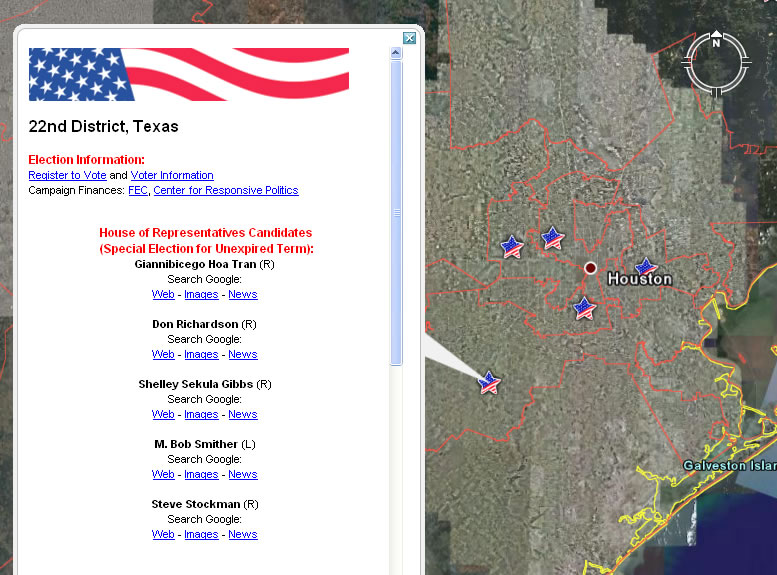
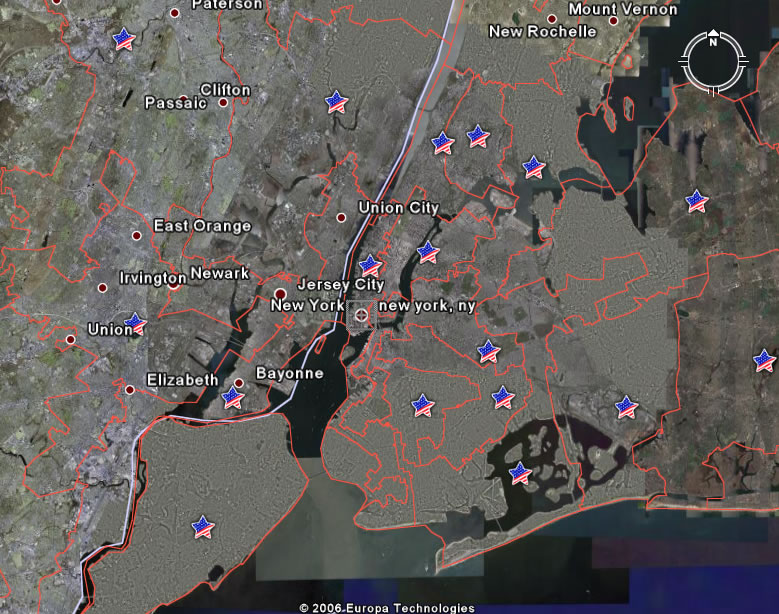
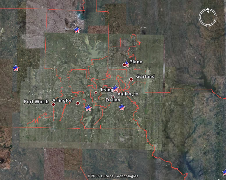
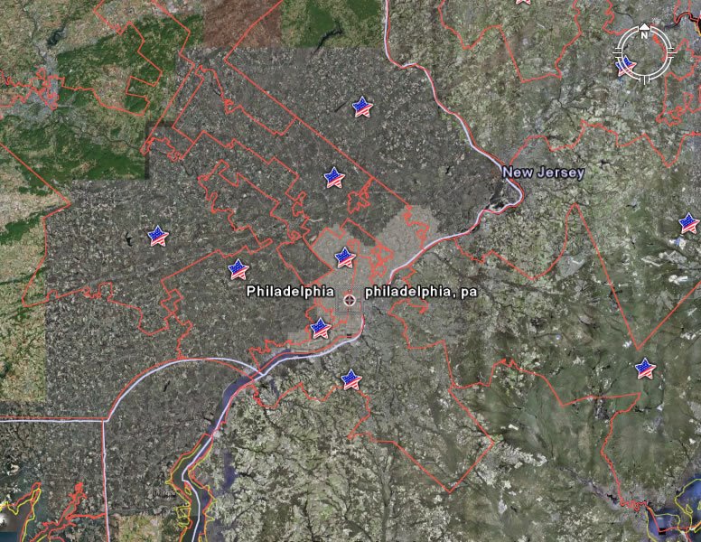
Far more interesting than the information available about candidates is this easy birds-eye view of the gerrymandering that has captured our system. Click on any of the cities below to see the monsters that Safe Seat congressional districting has created:
| Los Angeles | New York City |
 |  |
| Dallas/Ft. Worth | Philadelphia |
 |  |
Thanks, Don!
Categories:
politics,
technology
![]()


No comments:
Post a Comment